
COMPUTER VISION FOR CROP BREEDING
Image Safari
Capture of the world’s largest imagery dataset for crop phenotyping, to teach AI
Crop breeding runs on human eyes.
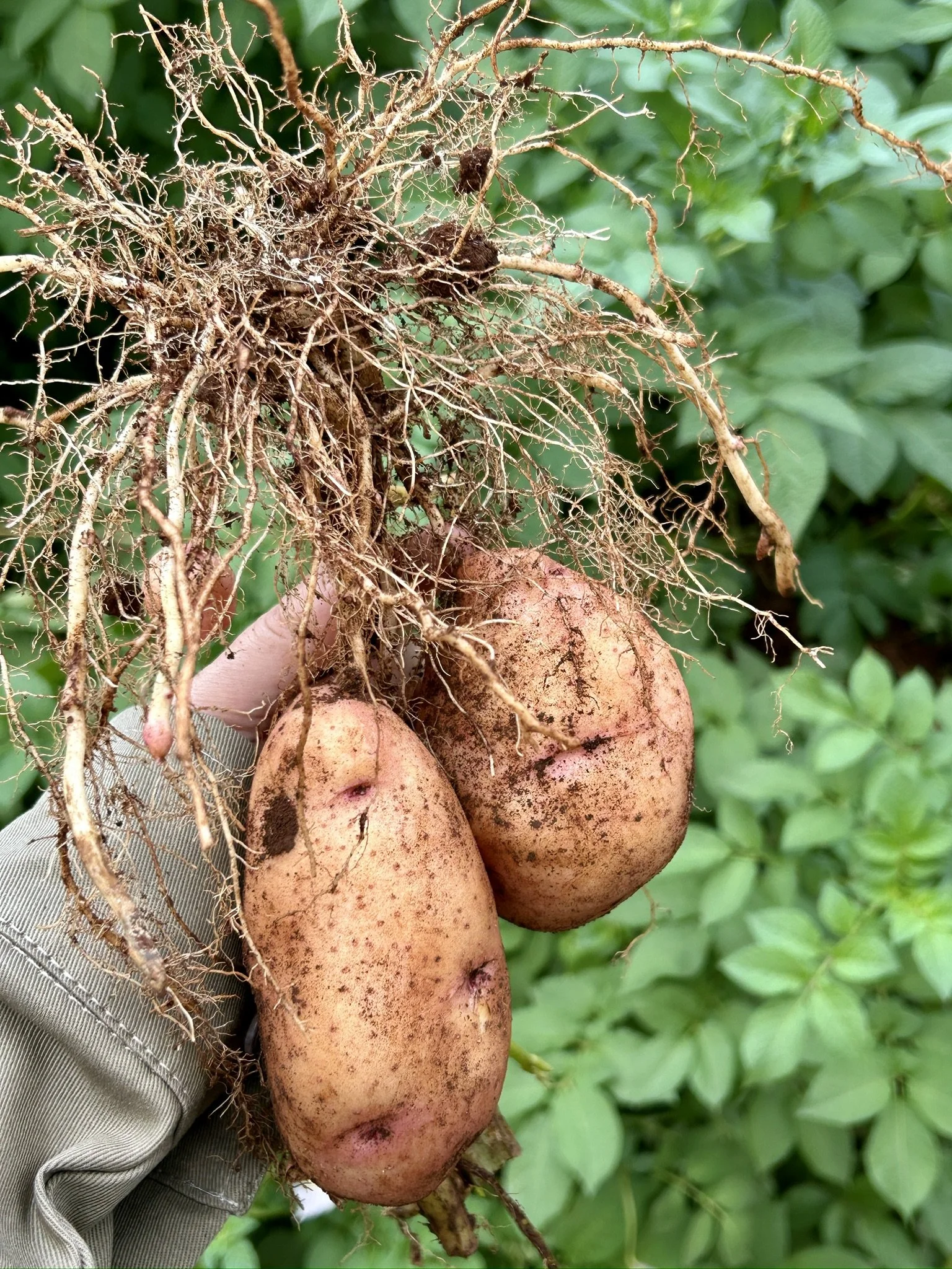
Example: A single potato plant lifted for assessment — tuber count, size and quality, judged by eye.
Every kernel of corn, grain of rice, or tuber of potato that we eat came from a variety that a breeder carefully selected. Breeders spend lifetimes optimizing for disease resistance, nutrition, drought, and yield. They assess thousands of plots a day, by looking at them. For many crops in the Global South, this work rests on a very small number of experts. The processs is slow, subjective, and error-prone — and limits how fast new varieties reach farmers.
Image Safari captures the data necerssary to automate the visual phenotyping of crop traits, so breeding can move at the speed of climate change.
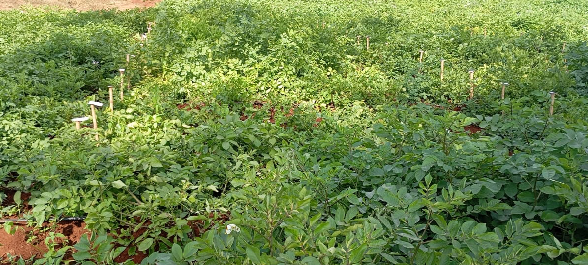
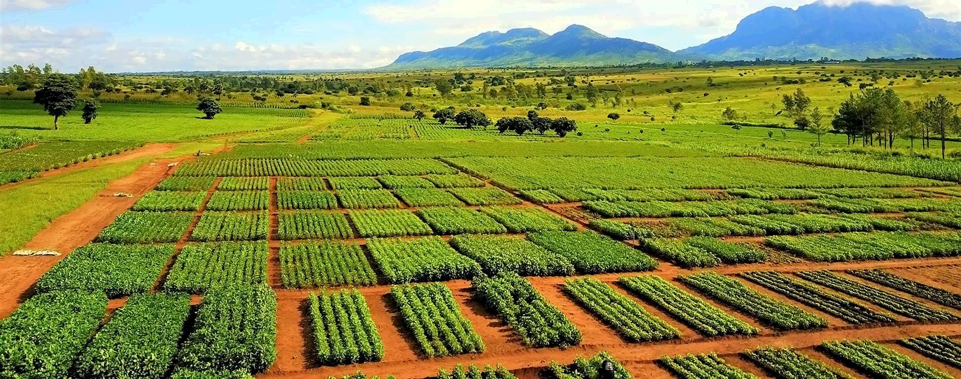
Now multiply it. Every labelled stake marks a separate experimental plot, and every plot needs scoring!
7.4M+
FIELD IMAGES CAPTURED
18
CROPS IN SCOPE
9
AFRICAN COUNTRIES
26K+
IMAGES EXPERTLY ANNOTATED
THE PIPELINE
From a phone in a field to trait prediction
Completed
01
Capture
Enumerators photograph plots with smartphones or harness-mounted GoPros, both driven by QED.ai tools.
02
Geo-reference
Scanning the plot's QR code links every image to plot, genotype and trial metadata from breeding systems.
03
Annotate
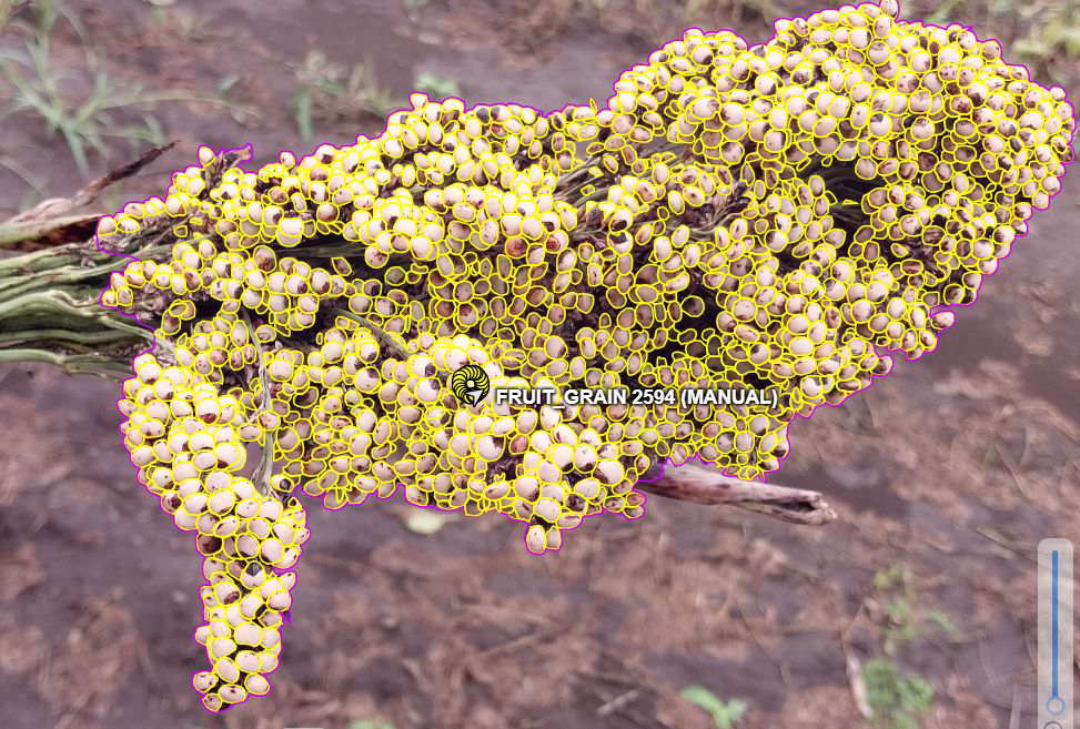
Analysts label leaves, flowers, reproductive organs and assign disease scores.
In Progress
04
Train & validate
Vision and vision-language models are trained, then tested across seasons and environments.
05
Deploy
Best models ship as mobile apps and cloud APIs returning in-field trait predictions.
STEP 01, UP CLOSE
Two capture methods
APPROACH ONE
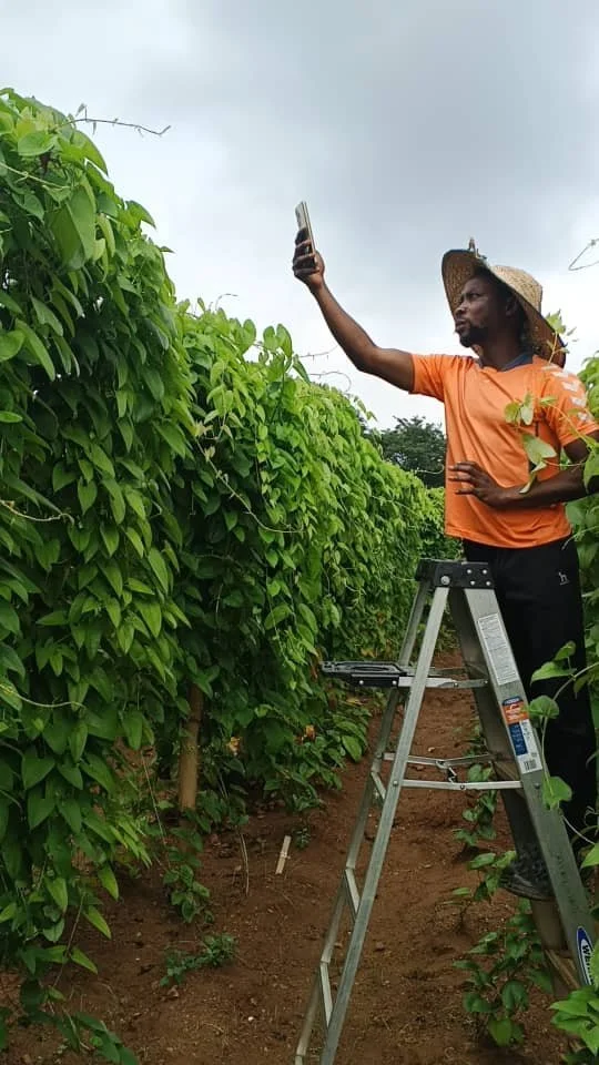
Smartphone in hand
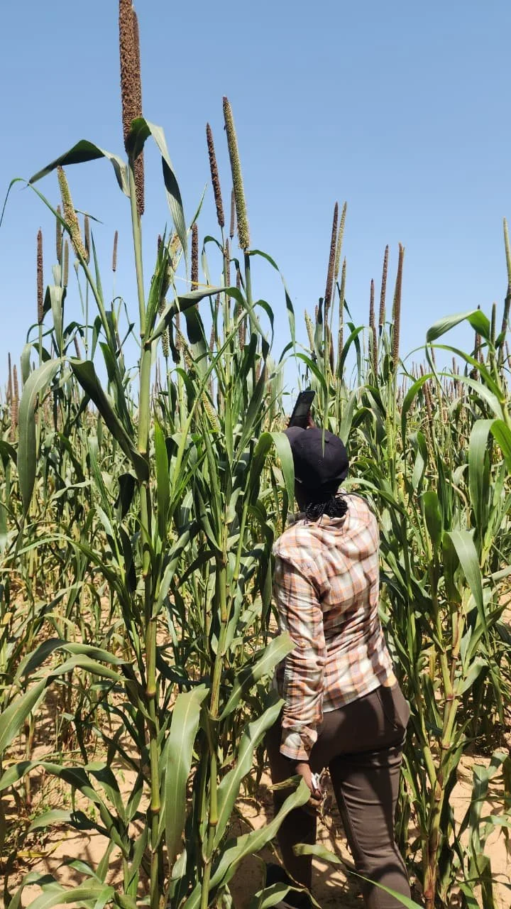
An enumerator opens the Crop Scout form, scans the plot's QR code to bind the session to a plot ID, records the crop's growth stage, then launches the QED Camera app from inside the form. The camera automatically fires every three seconds while the enumerator traverses the plot along the crop rows, gathering top, oblique and side views — the operator concentrates on coverage rather than on the shutter. No hardware beyond the phone already in their pocket — which is why a station can begin collecting the same day it is trained.
A second form, Illness Scout, is filled only when an outbreak reaches severity 7 or above, so the dataset records real disease events rather than the minor blemishes present in every plot.
STANDARDIZED CAPTURE
Three angles, every plot
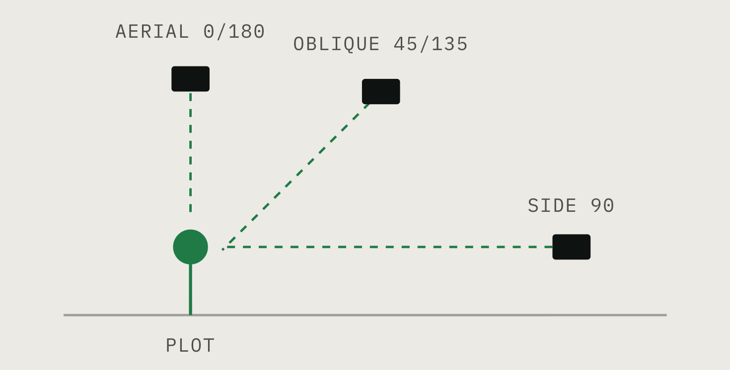
A protocol governs how each plot is shot, so imagery from a station in Senegal is comparable to imagery from one in Tanzania. Enumerators walk the rows in a fixed serpentine pattern — entering at the QR-coded stake, working each row in the opposite direction to the last — and photograph from three prescribed angles. All imagery is georeferenced.
DIVERSITY
All growth stages, soil and breeding conditions.
UPLOAD
Same day, over station Wi-Fi or preloaded data, with auto-send and delete-after-send keeping devices from filling up.
18 crops that feed the Global South
Staples and under-resourced crops alike — chosen with CGIAR breeders for their importance to food security in the Global South.
APPROACH TWO
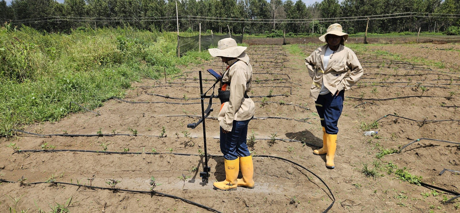
GoPro cameras on the Marchin’
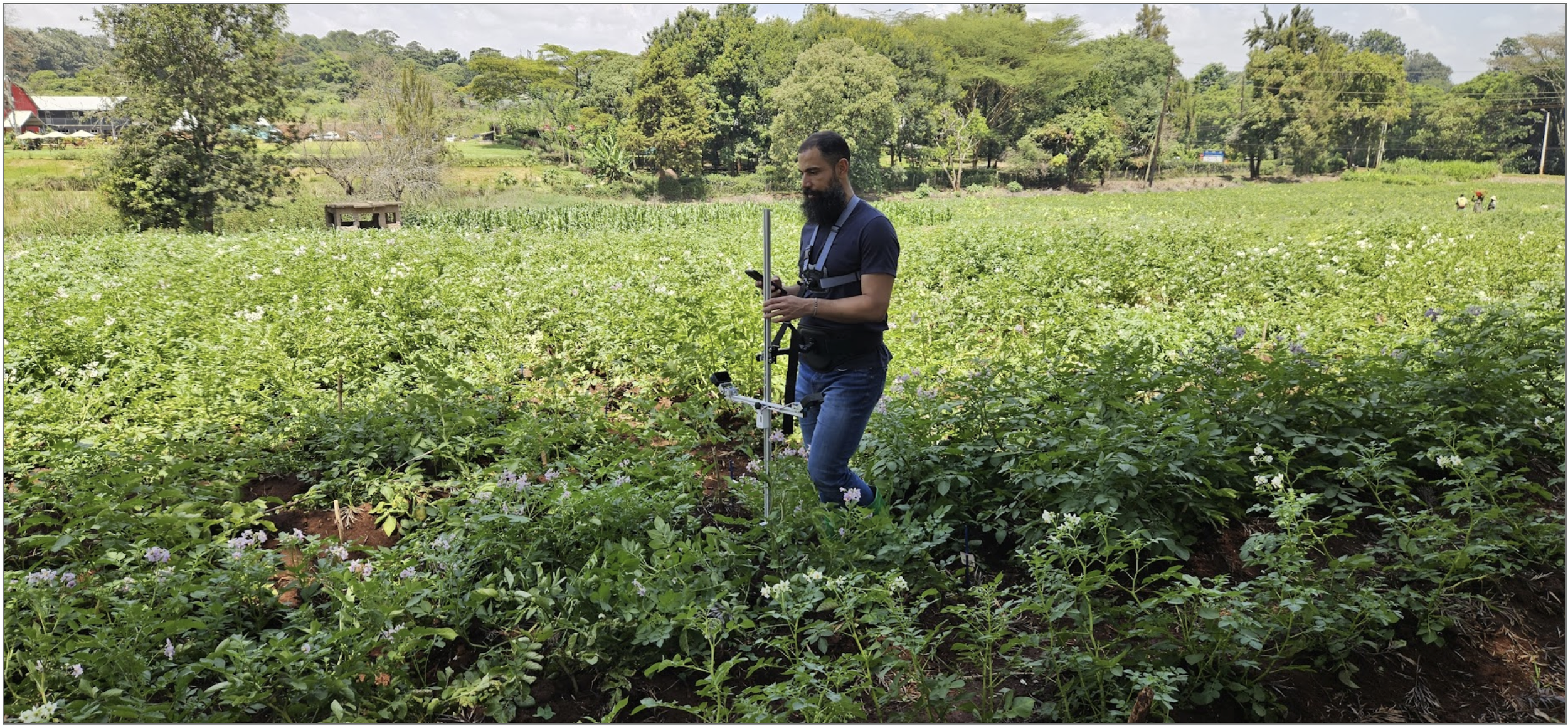
The Marchin’ is a custom-designed, locally-assembled mount: a chest-and-waist harness holding a vertical bar, with horizontal arms carrying several GoPro Hero 13 Black cameras fixed at chosen angles. The phone becomes the controller, pairing the cameras through the QED Camera app, previewing to confirm they are aimed correctly, then starting capture at two-second intervals while the enumerator walks the rows hands-free.
Because the angles are fixed by the rig rather than chosen shot by shot, the imagery is far more uniform across a trial. Where the Marchin’ cannot fit — dense banana canopy, for instance — a single GoPro goes on an extendable two-meter pole instead.
TIME OF DAY
Morning, mid-morning and afternoon, so the models learn the crop rather than the light.
FREQUENCY
Daily. Crops change overnight in ways the eye does not register — and after rain, with water still on the leaves.
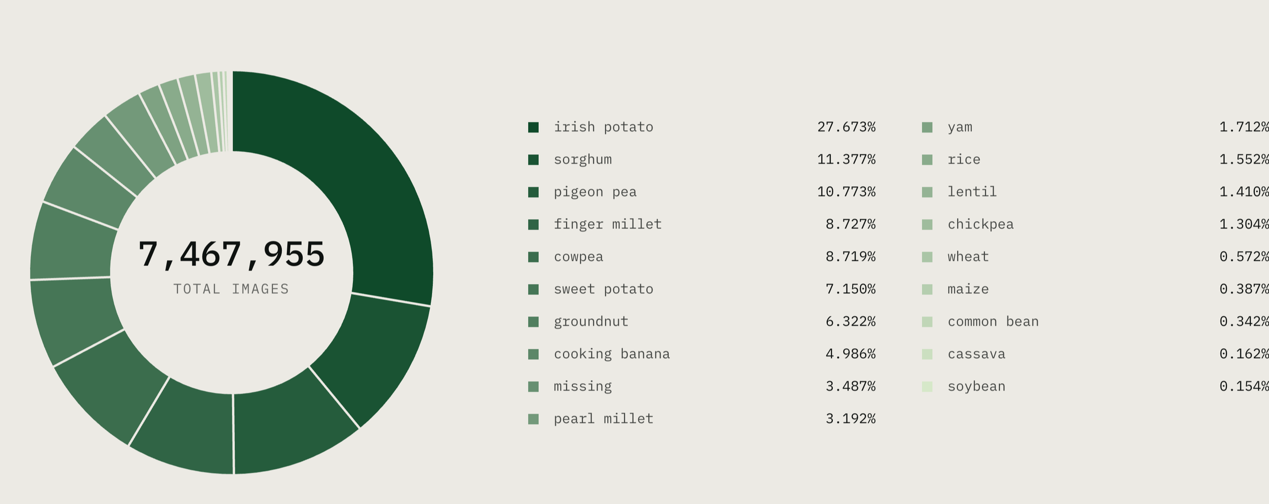
SHARE OF FIELD IMAGERY BY CROP
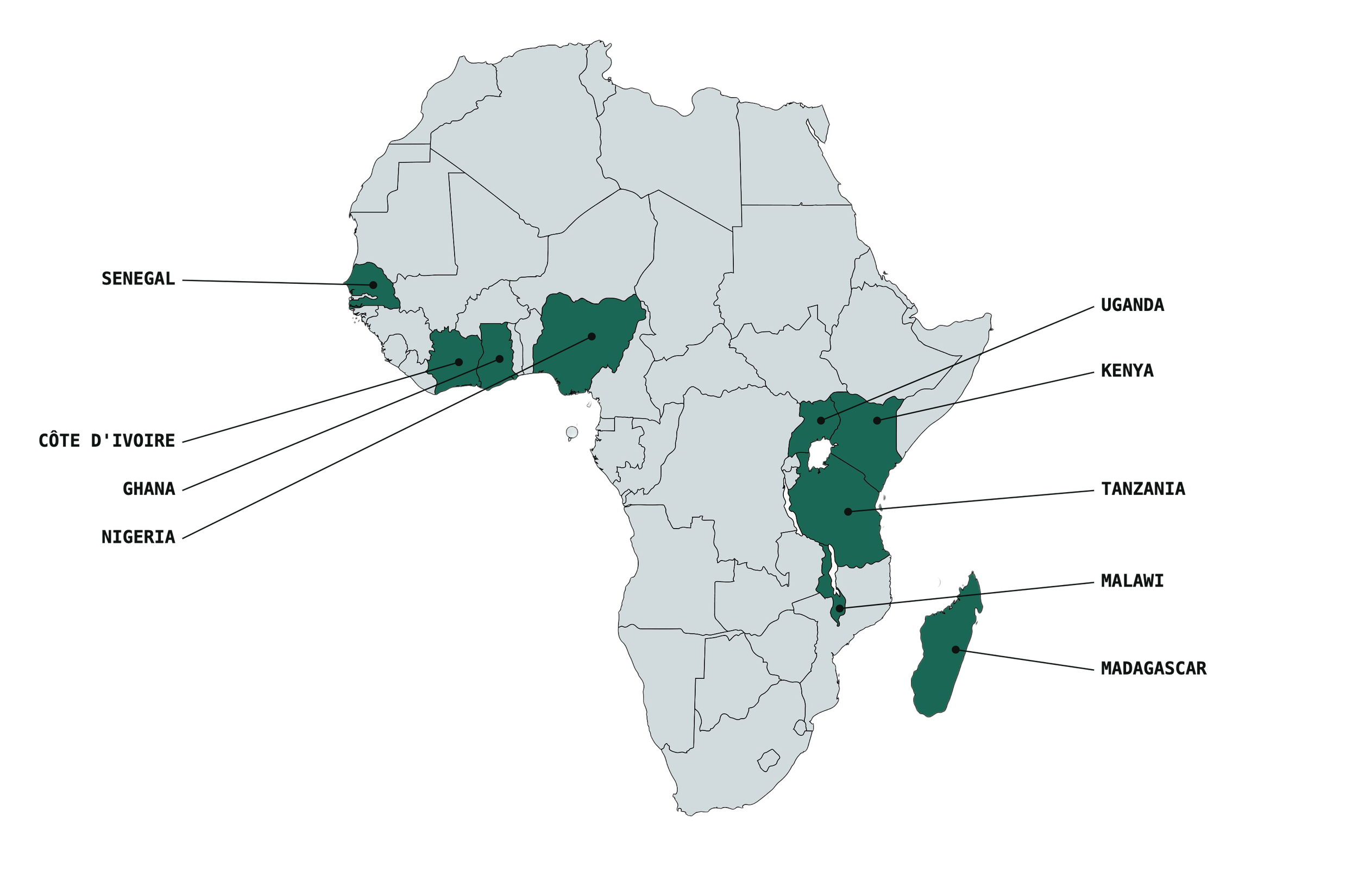
WHERE WE WORK
Data collection across the Africa Drylands
Inside the dataset
Part One - Field Images
More than 7.4 million raw images of the 18 priority crops, taken at different times of day and growth stages.
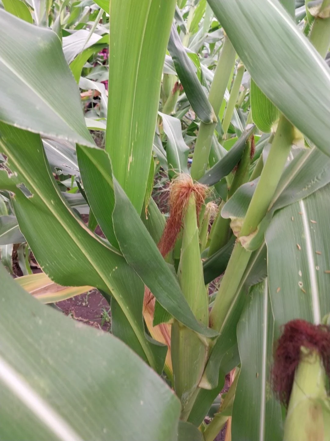
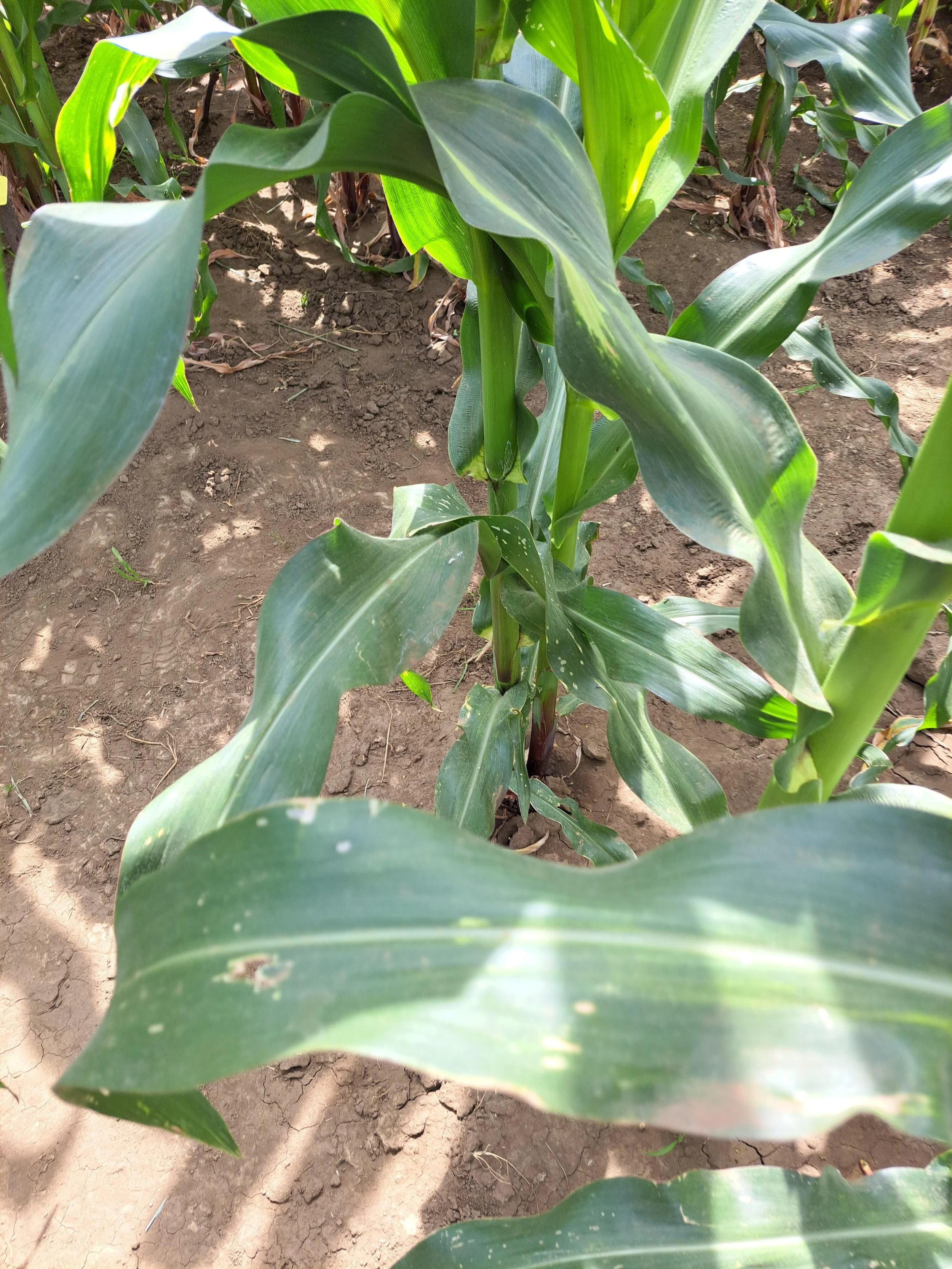
Maize - from Tanzania
Including more than 400K images of crops with illnesses, pest damage or malnutrition.
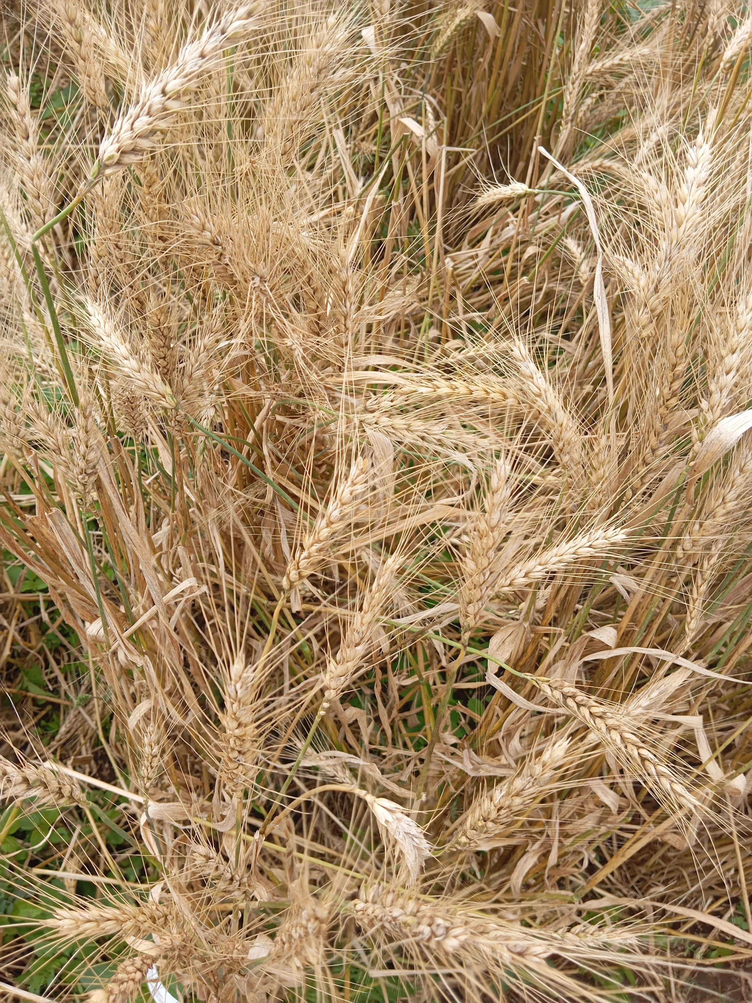
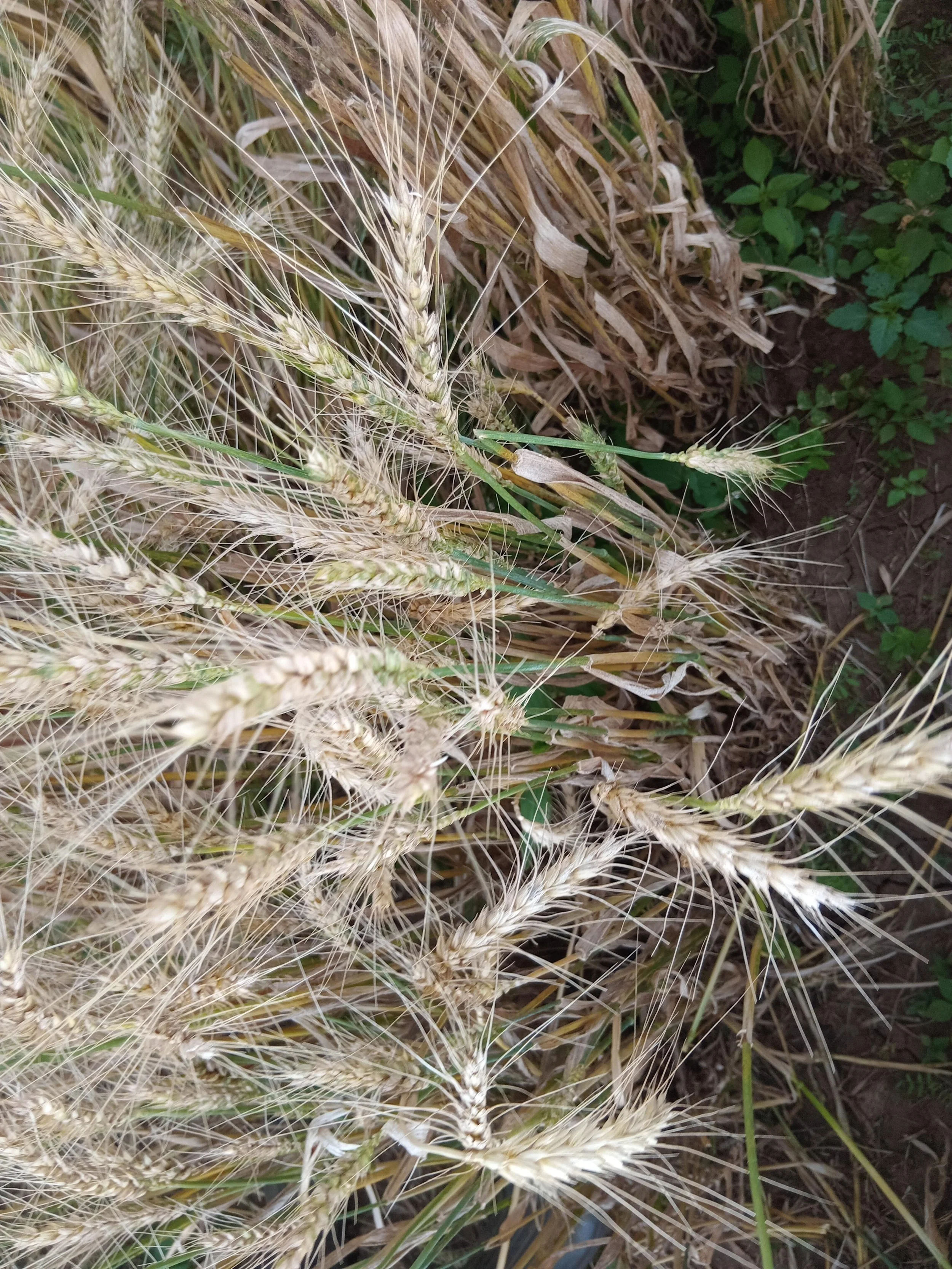
Wheat - from Kenya
Sorghum - from Senegal
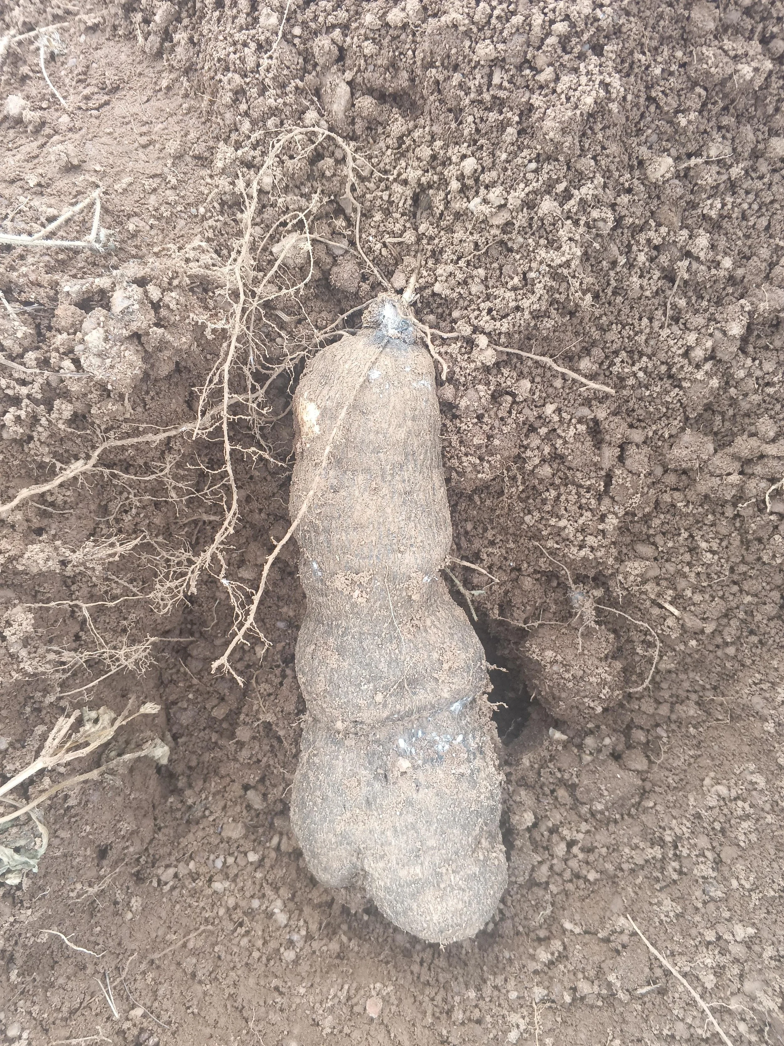
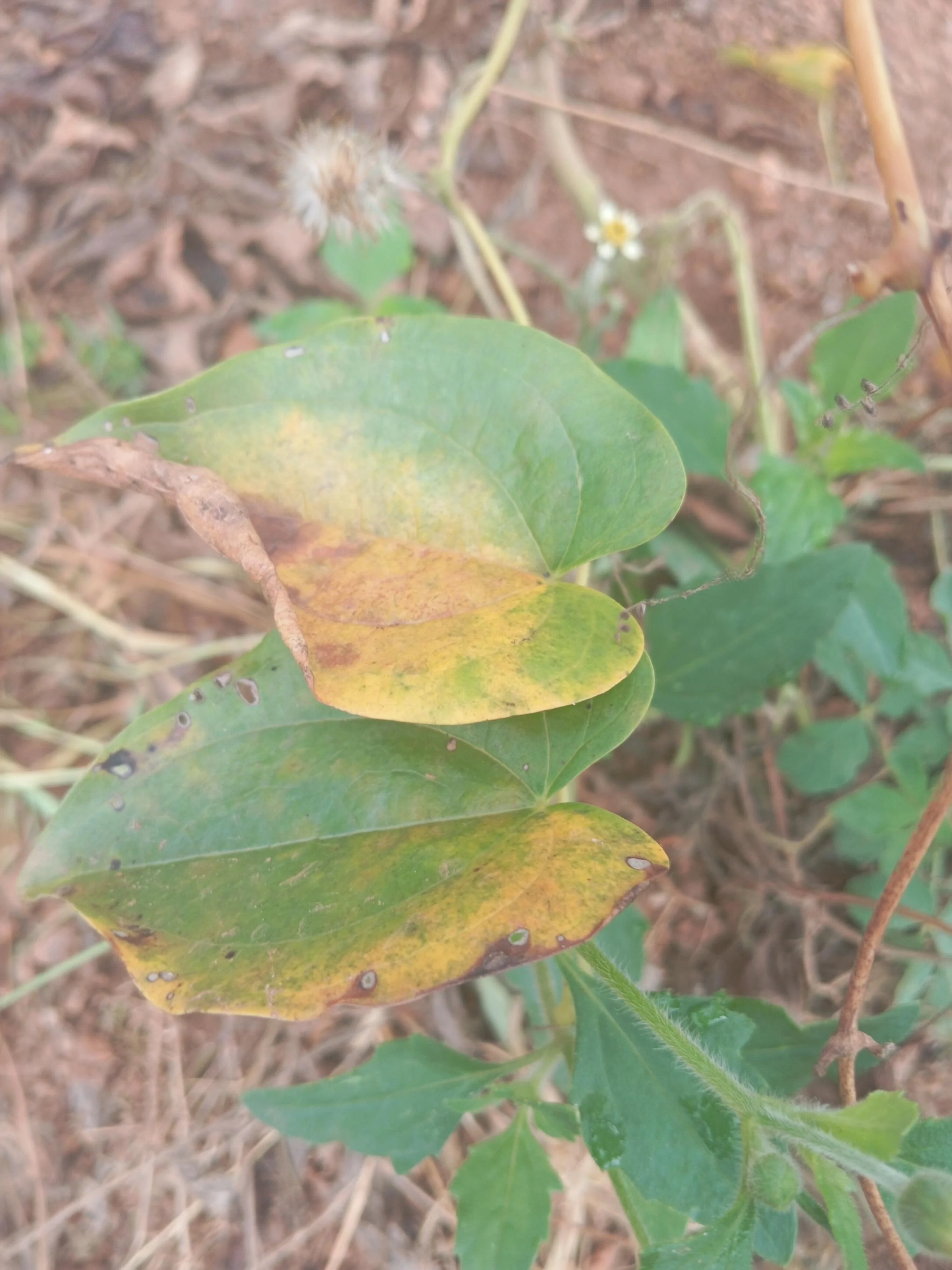
Yam - from Nigeria
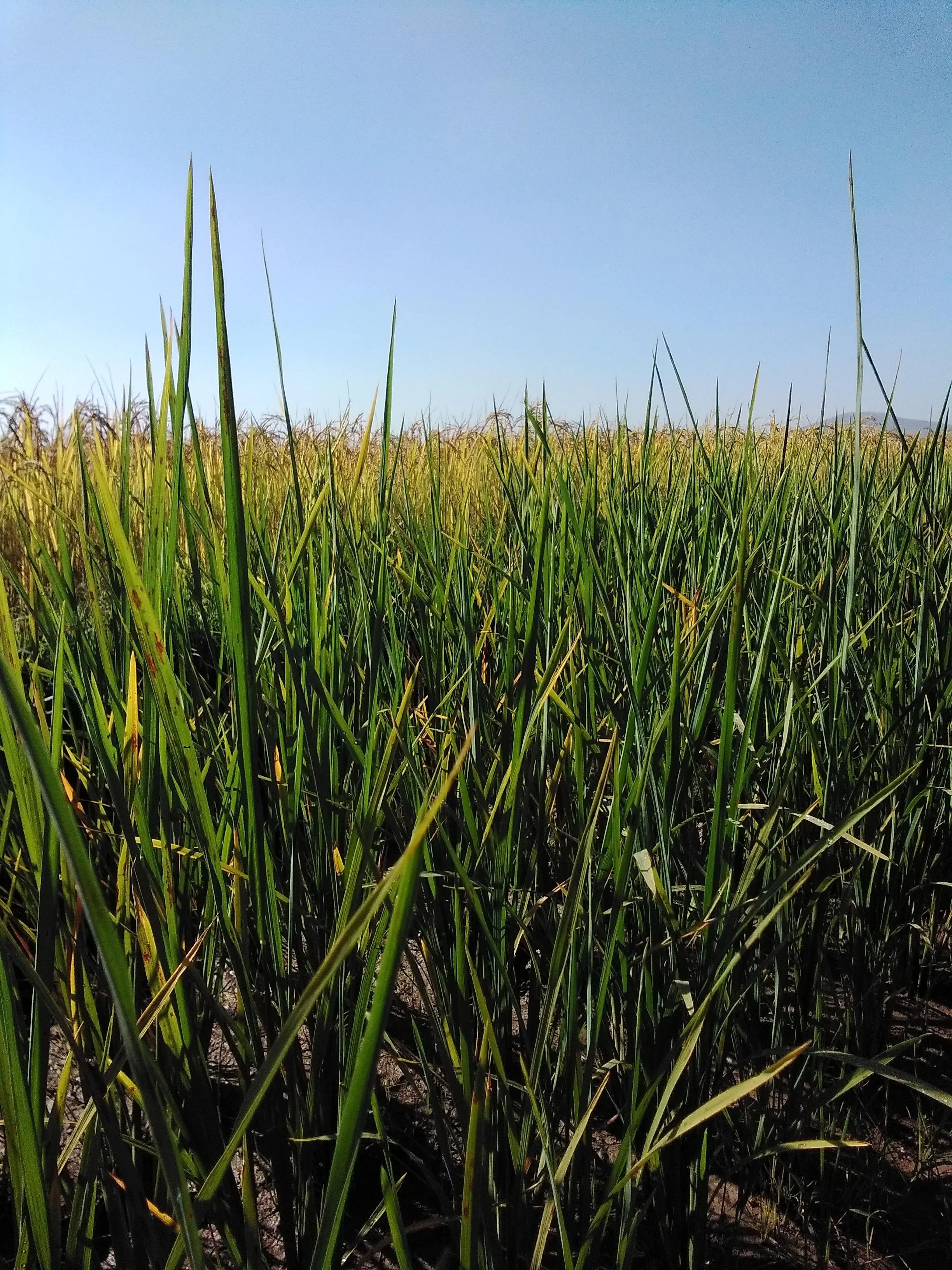
Rice - from Madagascar
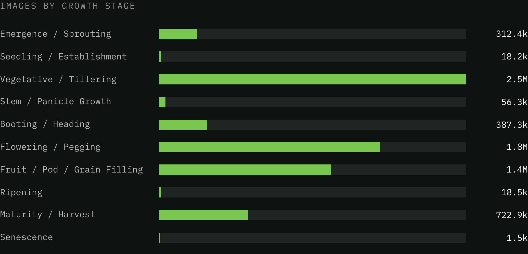
Emergence to senesence
A model is only as good as the range it has seen. Because every plot is photographed repeatedly through the season, the dataset spans the full crop calendar rather than the photogenic middle of it.
The weighting follows the calendar itself: vegetative growth and flowering last weeks, while ripening and senescence pass in days.
Part Two - Annotated Images
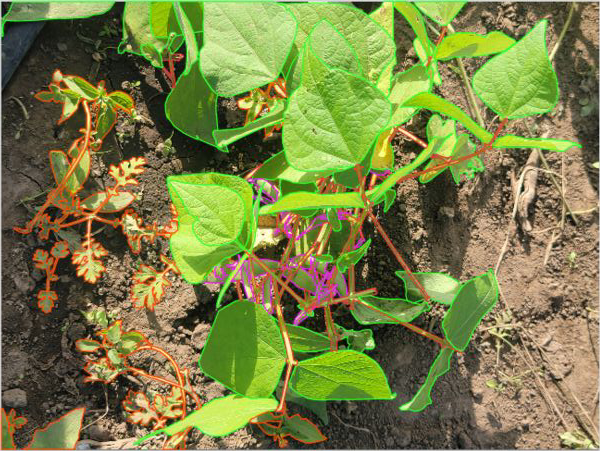
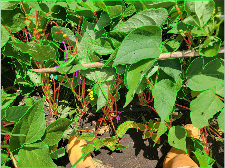
Watch an annotator at work
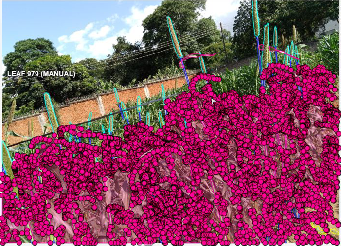
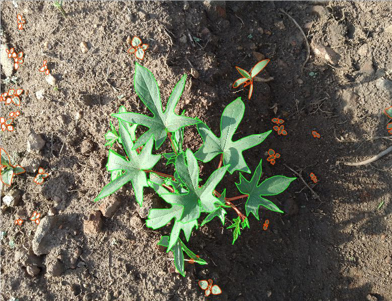
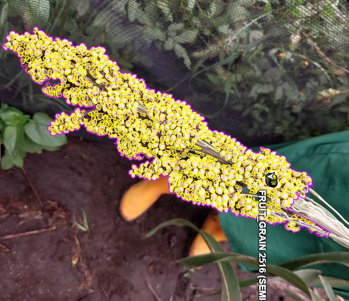
The labeled subset of more than 26K annotations turns imagery into training data. Seven different annotation styles, matched to the trait each crop programme needs.
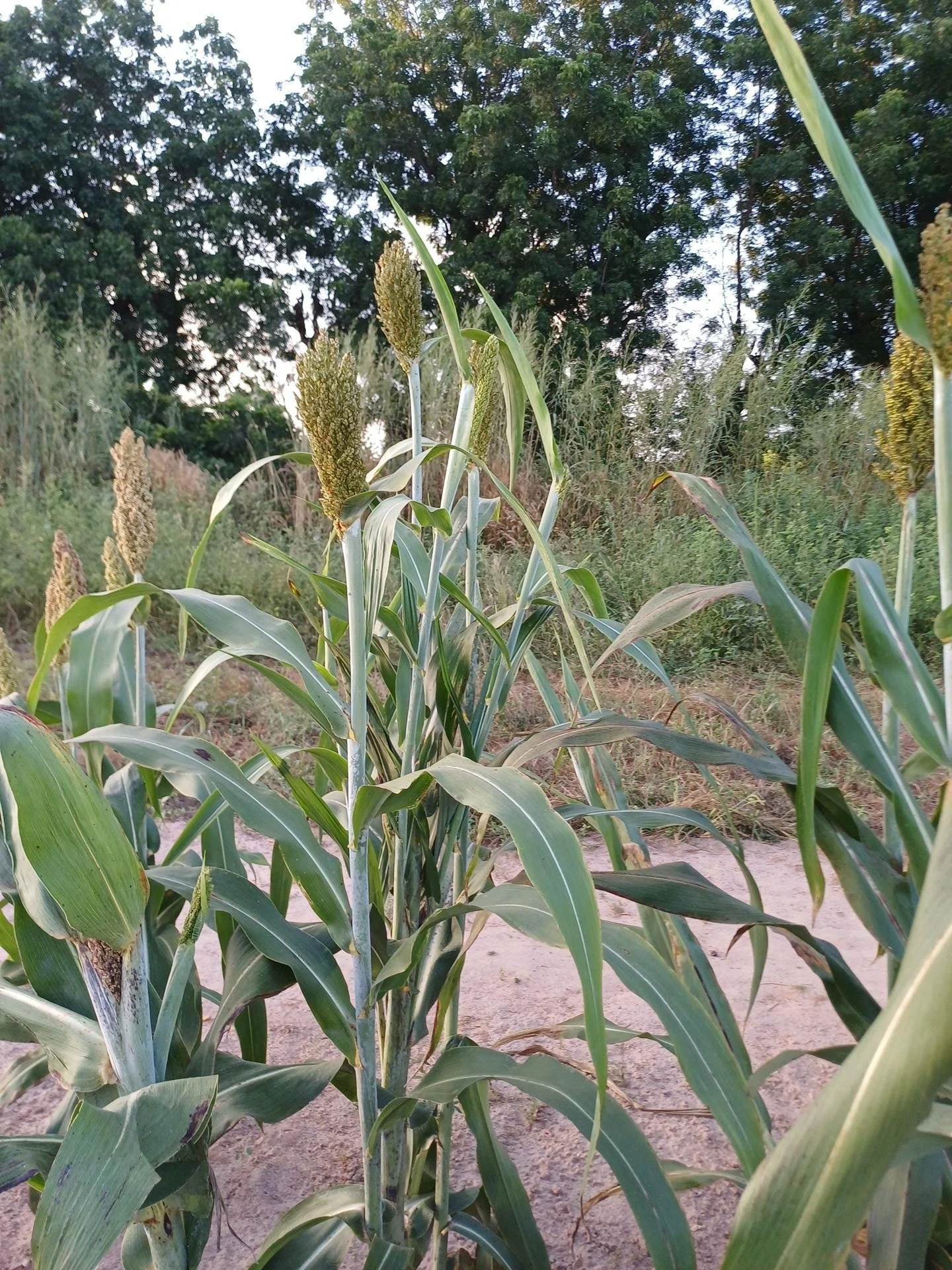
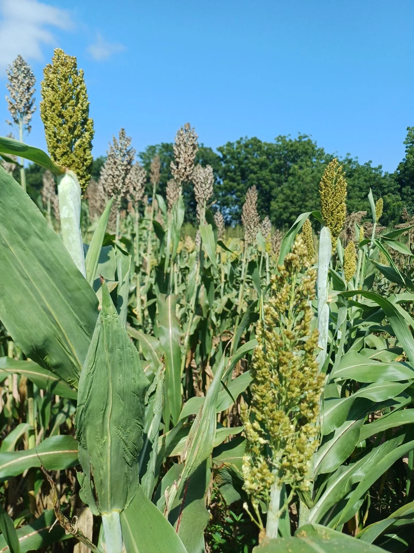
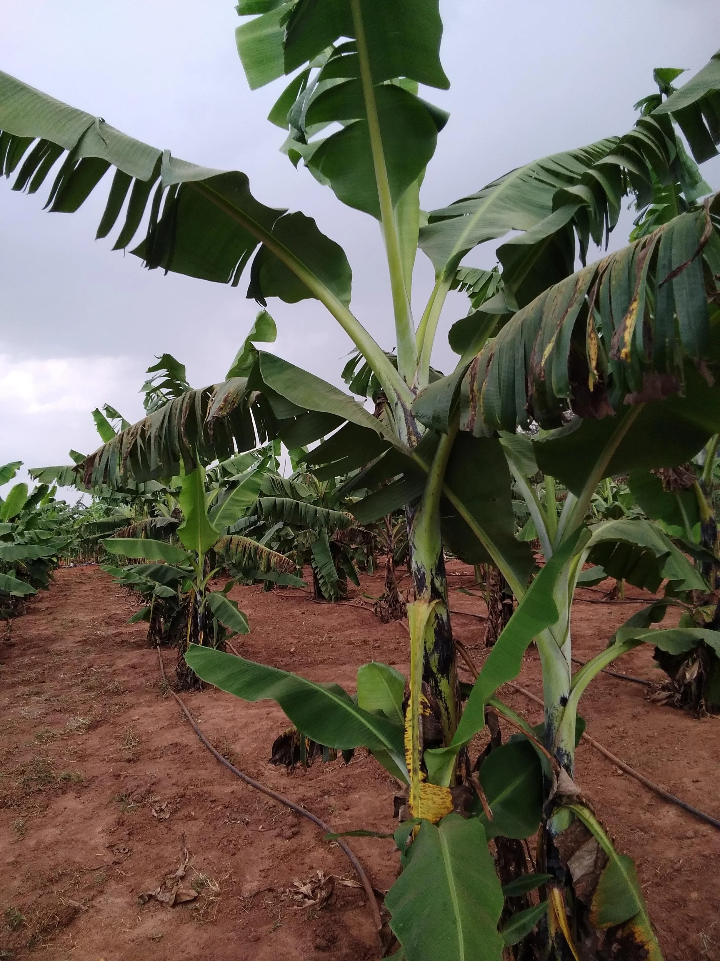
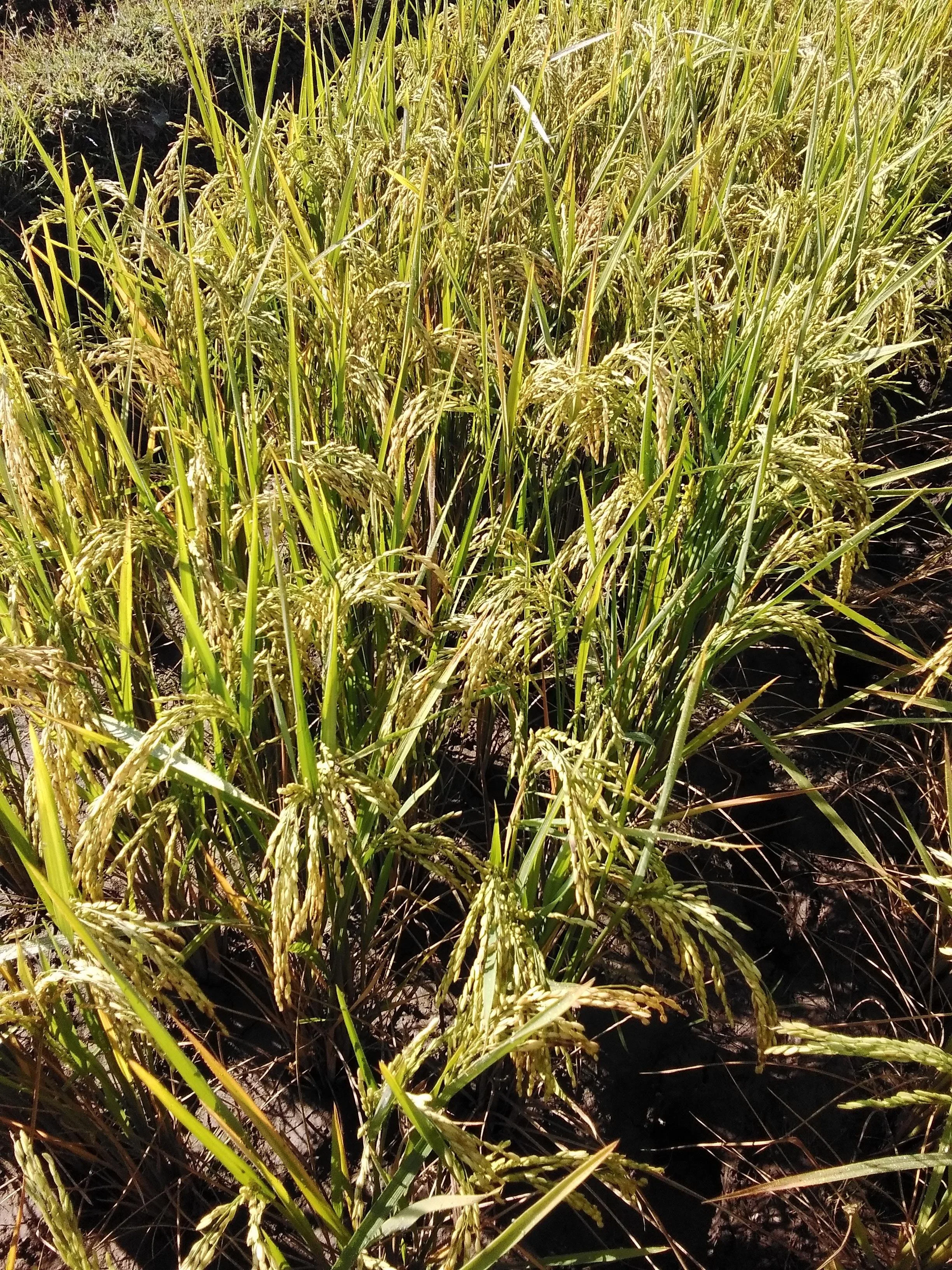
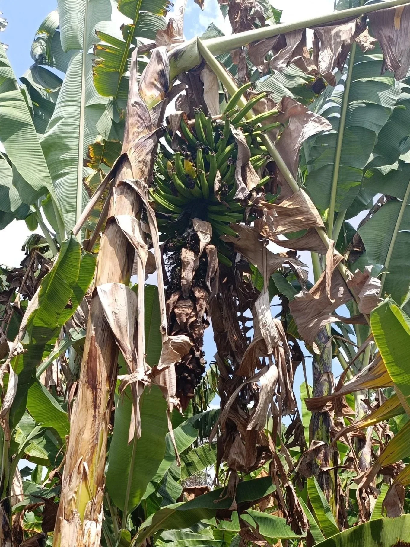
Banana - from Uganda
“AI is not magic. It requires data. We are building the foundational dataset that will drive future innovations in AI for breeding.”
DR. WILLIAM WU - QED.AI
IN COLLABORATION WITH
CGIAR
BREEDING SCIENCE & IMAGERY COLLECTION
Provides breeding stations for data collection and best-in-class agronomic expertise across crops and regions.


WITH SUPPORT FROM

GOOGLE RESEARCH
ARTIFICIAL INTELLIGENCE
Contributes computer vision and multi-modal model expertise to turn imagery into trait predictions.